")
")


Saint-Antonin-Noble-Val (Roc d'Anglars)
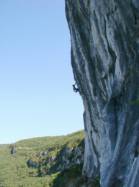
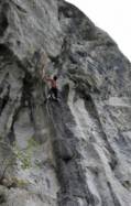
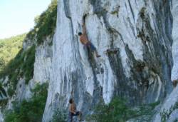


Interesting rock climbing area for routes from 6a to 6c, from 7a to 7c and starting from 8a (french grades).
Best time(s) :
- January
- February
- March
- April
- May
- June
- July
- August
- Sept.
- Oct.
- Nov.
- Dec.
Aspect(s) : N Altitude : 350 m
Approach 10 min down hill. Kids friendly ? foot of the crag uneven for young kids.
Informations :
More than 100 routes, from 4c to 8b. Bolting : sport climbing
Max Height : 80 m.
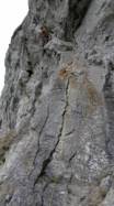
Rock :
limestone. Characteristic(s) : steep wall  , vertical
  . Type(s) of holds : crimps, cracks, ribs.
Locations :
Area :
France, Occitanie, Tarn-et-Garonne (82), Montauban, Saint-Antonin-Noble-Val.
|
|
Latitude : 44° 8' 39" N | Longitude : 1° 45' 54" E | Sexagesimal & Orientation |
|
|
Latitude : 44° 8' 38" N | Longitude : 1° 46' 4" E | Sexagesimal & Orientation |
| More coordinates |
Area added by CA