")
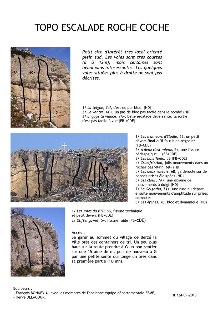
")


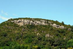
Roche-Coche
.JPG)
Interesting rock climbing area for routes up to 5c and from 6a to 6c (french grades).
Best time(s) :
- January
- February
- March
- April
- May
- June
- July
- August
- Sept.
- Oct.
- Nov.
- Dec.
Aspect(s) : SW-S Altitude : 400 m
Approach 15 min up hill. Kids friendly ? foot of the crag dangerous for young kids.
Informations :
Between 10 and 25 routes, from 5b to 7b. Bolting : sport climbing
Max Height : 12 m.
Rock :
limestone. Characteristic(s) : dihedral  , vertical
  , slab
  . Type(s) of holds : side pulls, underclings, jugs, pockets / holes, crimps, cracks, limestone channels, slopers.
Further information(s) : Un utilisateur a signalé que le port du casque est "plus que conseillé".
Locations :
Area :
France, Bourgogne-Franche-Comté, Saône-et-Loire (71), Macon, Berzé-la-Ville.
|
|
Latitude : 46° 22' 2" N | Longitude : 4° 42' 17" E | Sexagesimal & Orientation |
|
|
Latitude : 46° 21' 59" N | Longitude : 4° 42' 24" E | Sexagesimal & Orientation |
| More coordinates |
Area added by someone who did not leave her/his name :)