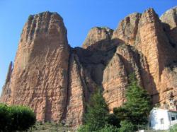
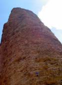
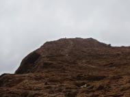
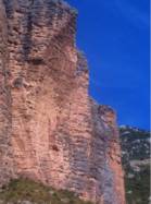
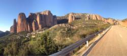
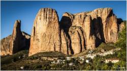
Riglos
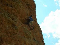
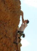
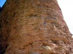
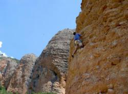
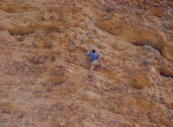
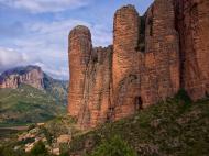
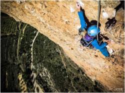
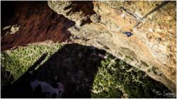
Interesting rock climbing area for routes from 7a to 7c and starting from 8a (french grades).
![Information](/images/attention.png)
Many additional skills about progressing, belaying, escaping technics ... are necessary for multipitch routes security.
Best time(s) : - January
- February
- March
- April
- May
- June
- July
- August
- Sept.
- Oct.
- Nov.
- Dec.
Aspect(s) : All Altitude : 650 m
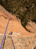
Approach between 5 and 30 min up hill. Kids friendly ? foot of the crag uneven for young kids.
Informations :
More than 200 routes, from 4b to 7c , spread over 2 crags Bolting : traditionnal climbing, sport climbing
Max Height : 300 m.
Rock :
conglomerate.
Characteristic(s) : slab
![Dalle](/images/dalle.png)
, vertical
![Vertical](/images/vertical.png)
, steep wall
![Dévers](/images/legerdevers.png)
.
Type(s) of holds : slopers.
Locations :
Area :
Spain, Aragón, Provincia de Huesca, Huesca, Ayerbe.
![Information](/images/readme.png)
1. Zoom in to get all the rock climbing places 200 km around.
![](/images/mm_20_green.png)
: Bouldering
![](/images/mm_20_orange.png)
: Single pitch
![](/images/mm_20_red.png)
: Multi pitches
![](/images/mm_20_blue.png)
: Deep water soloing
![](/images/mm_20_white.png)
: Differents kind of climbing
Rock climbing area GPS Coordinates : |
Latitude : 42° 21' 2" N |
Longitude : 0° 43' 41" W |
Sexagesimal & Orientation
|
|
Latitude : 42° 21' 2" |
Longitude : -0° 43' 41" |
Degrees, Minutes, Seconds (DMS)
|
|
Latitude : 42° 21.044' |
Longitude : -0° 43.691' |
Degrees, Décimal minutes (DM)
|
|
Latitude : 42.350729° |
Longitude : -0.728177° |
Decimal degrees (DD)
|
|
Parking lot GPS Coordinates : |
Latitude : 42° 20' 55" N |
Longitude : 0° 43' 39" W |
Sexagesimal & Orientation
|
|
Latitude : 42° 20' 55" |
Longitude : -0° 43' 39" |
Degrees, Minutes, Seconds (DMS)
|
|
Latitude : 42° 20.928' |
Longitude : -0° 43.653' |
Degrees, Décimal minutes (DM)
|
|
Latitude : 42.348801° |
Longitude : -0.727555° |
Decimal degrees (DD)
|
VIDEOS
Area added by CA