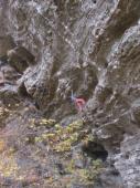
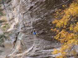
Red River Gorge (The Motherlode)
Interesting rock climbing area for routes from 7a to 7c and starting from 8a (french grades).
Best time(s) :
- January
- February
- March
- April
- May
- June
- July
- August
- Sept.
- Oct.
- Nov.
- Dec.
Aspect(s) : W-SW-S-SE Altitude : 300 m
Approach 15 min up hill. Kids friendly ? foot of the crag reasonable for young kids.
Informations :
Between 50 and 100 routes, from 5.10d to 5.14d. Bolting : sport climbing
Max Height : 50 m.
Rock :
sandstone. Characteristic(s) : overhang  , steep wall
  , vertical
  . Type(s) of holds : side pulls, underclings, pockets / holes, crimps, cracks, slopers.
Legendary route(s) :
Omaha beach 5.14a 1st female onsight 5.14a(8b+) by Katie Brown on 11 april 1999.
Thanatopsis 5.14b sent by Sasha Digiulian on 1 nov 2014. First repeat : Michaela Kiersch (2016)
Further information(s) : Stick-clip needed for the first bolt of many routes.
Don't park close to oil stuffs.
La piste qui descend aux parkings est à présent défoncée et les véhicules standards ne peuvent plus remonter ... Un véhicule 4x4 est nécessaire. (octobre 2016).
La piste qui descend aux parkings est à présent défoncée et les véhicules standards ne peuvent plus remonter ... Un véhicule 4x4 est nécessaire. (octobre 2016).
Locations :
Area :
United States, Kentucky, Lee County, Lexington, Stanton, Beattyville.
|
|
Latitude : 37° 38' 47" N | Longitude : 83° 42' 34" W | Sexagesimal & Orientation |
|
|
Latitude : 37° 38' 40" N | Longitude : 83° 42' 50" W | Sexagesimal & Orientation |
| More coordinates |
VIDEOS
Area added by CA


