")
")


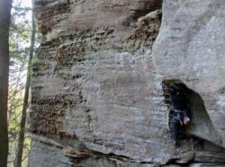
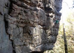
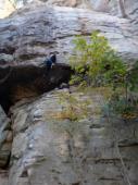
Red River Gorge (Phantasia Wall)


Interesting rock climbing area for routes from 6a to 6c and from 7a to 7c (french grades).
Best time(s) :
- January
- February
- March
- April
- May
- June
- July
- August
- Sept.
- Oct.
- Nov.
- Dec.
Aspect(s) : E Altitude : 350 m
Approach 5 min up hill. Kids friendly ? foot of the crag reasonable for young kids.
Informations :
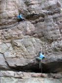
Between 10 and 25 routes, from 5.9 to 5.12d , spread over many crags Bolting : traditionnal climbing, sport climbing
Max Height : 25 m.
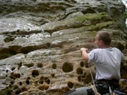
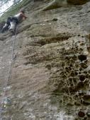
Rock :
sandstone. Characteristic(s) : vertical  , steep wall
  . Type(s) of holds : pockets / holes, cracks, slopers.
We liked this/these route(s) : Twinkie 5.12a
Further information(s) : 17 routes
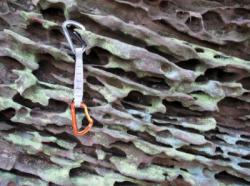
Stick-clip needed for the first bolt of many routes.
Stick-clip needed for the first bolt of many routes.
Locations :
Area :
United States, Kentucky, Menifee County, Lexington, Stanton, Slade.
|
|
Latitude : 37° 50' 53" N | Longitude : 83° 38' 42" W | Sexagesimal & Orientation |
|
|
Latitude : 37° 50' 53" N | Longitude : 83° 38' 39" W | Sexagesimal & Orientation |
| More coordinates |
Area added by CA