")
")


La Dent d'Orlu
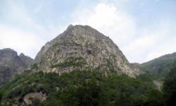
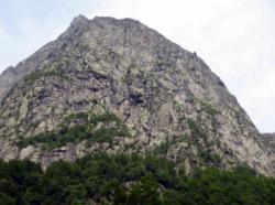
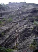
Interesting rock climbing area for routes from 6a to 6c and from 7a to 7c (french grades).
Best time(s) :
- January
- February
- March
- April
- May
- June
- July
- August
- Sept.
- Oct.
- Nov.
- Dec.
Aspect(s) : S-SE-E Altitude : 900 m
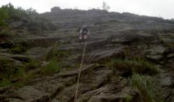
Approach between 15 and 45 min steep up hill. Kids friendly ? foot of the crag dangerous for young kids.
Informations :
Between 50 and 100 routes, from 3c to 7c. Bolting : traditionnal climbing, sport climbing
Max Height : 1150 m.
Rock :
granite. Characteristic(s) : dihedral  , vertical
  , slab
  . Type(s) of holds : crimps, cracks, slopers.
Locations :
Area :
France, Occitanie, Ariège (09), Foix, Aix-les-Thermes.
|
|
Latitude : 42° 41' 27" N | Longitude : 1° 56' 29" E | Sexagesimal & Orientation |
|
|
Latitude : 42° 40' 53" N | Longitude : 1° 56' 27" E | Sexagesimal & Orientation |
| More coordinates |
Area added by CA