Pointe de Cerdosse
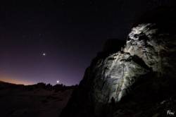
Interesting rock climbing area for routes from 6a to 6c (french grades).
![Information](/images/attention.png)
Many additional skills about progressing, belaying, escaping technics ... are necessary for multipitch routes security.
Best time(s) : - January
- February
- March
- April
- May
- June
- July
- August
- Sept.
- Oct.
- Nov.
- Dec.
Altitude : 2550 m
Approach 120 min up hill. Kids friendly ? foot of the crag uneven for young kids.
Informations :
Less than 10 routes, from 5b to 6b. Bolting : traditionnal climbing, big run out climbing
Max Height : 150 m.
Rock :
quartzite.
Characteristic(s) : dihedral
![Dièdre](/images/diedre.png)
, vertical
![Vertical](/images/vertical.png)
.
Type(s) of holds : crimps, cracks.
Locations :
Area :
France, Auvergne-Rhône-Alpes, Savoie (73), Bourg-Saint-Maurice, La Côte-d'Aime.
![Information](/images/readme.png)
1. Zoom in to get all the rock climbing places 200 km around.
![](/images/mm_20_green.png)
: Bouldering
![](/images/mm_20_orange.png)
: Single pitch
![](/images/mm_20_red.png)
: Multi pitches
![](/images/mm_20_blue.png)
: Deep water soloing
![](/images/mm_20_white.png)
: Differents kind of climbing
Rock climbing area GPS Coordinates : |
Latitude : 45° 37' 33" N |
Longitude : 6° 39' 3" E |
Sexagesimal & Orientation
|
|
Latitude : 45° 37' 33" |
Longitude : 6° 39' 3" |
Degrees, Minutes, Seconds (DMS)
|
|
Latitude : 45° 37.561' |
Longitude : 6° 39.06' |
Degrees, Décimal minutes (DM)
|
|
Latitude : 45.626022° |
Longitude : 6.650998° |
Decimal degrees (DD)
|
|
Parking lot GPS Coordinates : |
Latitude : 45° 36' 21" N |
Longitude : 6° 40' 25" E |
Sexagesimal & Orientation
|
|
Latitude : 45° 36' 21" |
Longitude : 6° 40' 25" |
Degrees, Minutes, Seconds (DMS)
|
|
Latitude : 45° 36.353' |
Longitude : 6° 40.433' |
Degrees, Décimal minutes (DM)
|
|
Latitude : 45.605881° |
Longitude : 6.673878° |
Decimal degrees (DD)
|
Area added by CA