")
")


Pierre-Lys
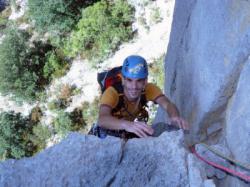
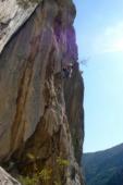
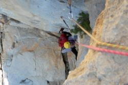

Interesting rock climbing area for routes from 6a to 6c, from 7a to 7c and starting from 8a (french grades).
Best time(s) :
- January
- February
- March
- April
- May
- June
- July
- August
- Sept.
- Oct.
- Nov.
- Dec.
Aspect(s) : All Altitude : 400 m
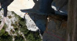
Approach 10 min by tyrolienne. Kids friendly ? foot of the crag dangerous for young kids.
Informations :
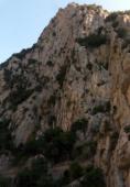
Between 50 and 100 routes, from 5a to 8a , spread over many crags Bolting : traditionnal climbing, sport climbing
Max Height : 300 m.
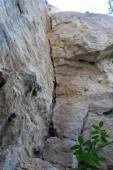
Rock :
limestone. Characteristic(s) : slab  , vertical
  , steep wall
  , dihedral
  . Type(s) of holds : cracks, crimps.
Web site(s) :
http://rocgenese.free.fr/blog/index.php?pages/Topos
Locations :
Area :
France, Occitanie, Aude (11), Quillan, Saint-Martin-Lys.
|
|
Latitude : 42° 50' 22" N | Longitude : 2° 12' 9" E | Sexagesimal & Orientation |
| More coordinates |
Area added by CA