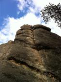
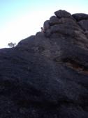
Mount Rushmore
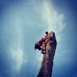
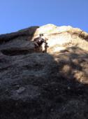
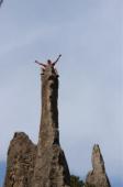
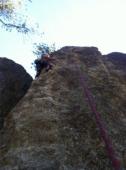
Interesting rock climbing area for routes from 7a to 7c and starting from 8a (french grades).
![Information](/images/attention.png)
Many additional skills about progressing, belaying, escaping technics ... are necessary for multipitch routes security.
Best time(s) : - January
- February
- March
- April
- May
- June
- July
- August
- Sept.
- Oct.
- Nov.
- Dec.
Aspect(s) : All Altitude : 1600 m
Approach
Informations :
More than 200 routes, from 5.6 to 5.13a , spread over many crags Bolting : traditionnal climbing, sport climbing
Max Height : 150 m.
Rock :
granite.
Characteristic(s) : slab
![Dalle](/images/dalle.png)
, vertical
![Vertical](/images/vertical.png)
.
Type(s) of holds : cracks.
Locations :
Area :
United States, South Dakota, Pennington County, Rapid City, Keystone.
![Information](/images/readme.png)
1. Zoom in to get all the rock climbing places 200 km around.
![](/images/mm_20_green.png)
: Bouldering
![](/images/mm_20_orange.png)
: Single pitch
![](/images/mm_20_red.png)
: Multi pitches
![](/images/mm_20_blue.png)
: Deep water soloing
![](/images/mm_20_white.png)
: Differents kind of climbing
Rock climbing area GPS Coordinates : |
Latitude : 43° 53' 11" N |
Longitude : 103° 28' 1" W |
Sexagesimal & Orientation
|
|
Latitude : 43° 53' 11" |
Longitude : -103° 28' 1" |
Degrees, Minutes, Seconds (DMS)
|
|
Latitude : 43° 53.193' |
Longitude : -103° 28.024' |
Degrees, Décimal minutes (DM)
|
|
Latitude : 43.886546° |
Longitude : -103.46707° |
Decimal degrees (DD)
|
|
Parking lot GPS Coordinates : |
Latitude : 43° 53' 14" N |
Longitude : 103° 28' 12" W |
Sexagesimal & Orientation
|
|
Latitude : 43° 53' 14" |
Longitude : -103° 28' 12" |
Degrees, Minutes, Seconds (DMS)
|
|
Latitude : 43° 53.238' |
Longitude : -103° 28.2' |
Degrees, Décimal minutes (DM)
|
|
Latitude : 43.887299° |
Longitude : -103.470001° |
Decimal degrees (DD)
|
Area added by CA