")
")


Frankenjura (Hohe Reute)
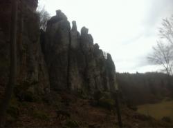


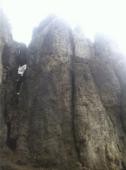

Interesting rock climbing area for routes up to 5c and from 6a to 6c (french grades).
Best time(s) :
- January
- February
- March
- April
- May
- June
- July
- August
- Sept.
- Oct.
- Nov.
- Dec.
Aspect(s) : SW Altitude : 600 m
Approach 5 min
Informations :
Between 25 and 50 routes, from 3 to 8-. Bolting : traditionnal climbing, sport climbing
Max Height : 18 m.
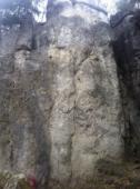
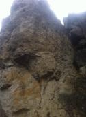
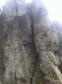
Rock :
limestone. Characteristic(s) : vertical  , slab
  . Type(s) of holds : crimps.
Locations :
Area :
Germany, Bayern, Regierungsbezirk Oberfranken, Nürnberg, Spies.
|
|
Latitude : 49° 38' 3" N | Longitude : 11° 24' 33" E | Sexagesimal & Orientation |
|
|
Latitude : 49° 38' 2" N | Longitude : 11° 24' 1" E | Sexagesimal & Orientation |
| More coordinates |
Area added by CA