")
")


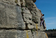
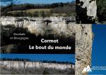
Cormot

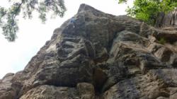


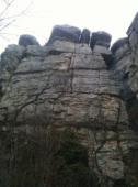

Interesting rock climbing area for routes up to 5c, from 6a to 6c and from 7a to 7c (french grades).
Best time(s) :
- January
- February
- March
- April
- May
- June
- July
- August
- Sept.
- Oct.
- Nov.
- Dec.
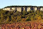
Aspect(s) : SW-S-SE Altitude : 500 m
Approach between 10 and 15 min easy up hill. Kids friendly ? foot of the crag reasonable for young kids.
Informations :
More than 200 routes, from 3a to 7c , spread over 3 crags Bolting : big run out climbing
Max Height : 35 m.
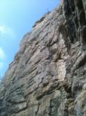
Rock :
limestone. Characteristic(s) : dihedral  , steep wall
  , vertical
  , slab
  . Type(s) of holds : crimps, cracks, slopers.
Further information(s) : Un beau site avec de nombreuses voies de 35m. Le pied des voies est ombragé. Le site est bien ré-équipé même si il reste encore à faire. Le calcaire n'est pas patiné... Mais un peu cassant (casque conseillé). Adapté à tous les niveaux.
Locations :
Area :
France, Bourgogne-Franche-Comté, Côte-d'Or (21), Beaune, Vauchignon.
|
|
Latitude : 46° 58' 17" N | Longitude : 4° 39' 4" E | Sexagesimal & Orientation |
|
|
Latitude : 46° 58' 6" N | Longitude : 4° 39' 13" E | Sexagesimal & Orientation |
| More coordinates |
Area added by CA