
")
")


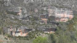
Cantobre
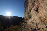
Interesting rock climbing area for routes from 6a to 6c, from 7a to 7c and starting from 8a (french grades).
Best time(s) :
- January
- February
- March
- April
- May
- June
- July
- August
- Sept.
- Oct.
- Nov.
- Dec.
Aspect(s) : S-SE-E Altitude : 500 m
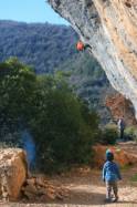
Approach between 15 and 20 min up hill. Kids friendly ? foot of the crag reasonable for young kids.
Informations :
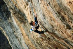
Between 50 and 100 routes, from 5c to 9a , spread over many crags Bolting : big run out climbing
Max Height : 40 m.
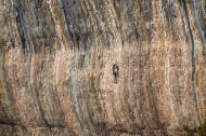
Rock :
limestone (dolomie). Characteristic(s) : steep wall  , vertical
  . Type(s) of holds : pockets / holes, crimps.
Legendary route(s) : Salida Del Sol 9a (F.A. Enzo Oddo novembre 2011)
Further information(s) : To purchase the topo or report a problem http://www.topo-tarn-jonte-dourbie.info/fr/
Locations :
Area :
France, Occitanie, Aveyron (12), Millau, Nant.
|
|
Latitude : 44° 3' 38" N | Longitude : 3° 18' 16" E | Sexagesimal & Orientation |
|
|
Latitude : 44° 3' 13" N | Longitude : 3° 18' 13" E | Sexagesimal & Orientation |
| More coordinates |
VIDEOS
Area added by CA


