
")
")


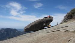
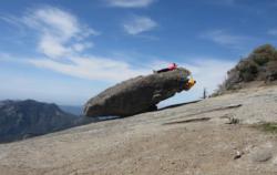
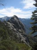
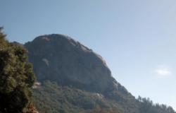
Moro Rock (Sequoia National Park)
.jpg)
.jpg)

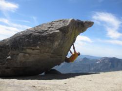
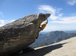
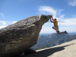

Interesting rock climbing area for routes from 6a to 6c and from 7a to 7c (french grades).
Best time(s) :
- January
- February
- March
- April
- May
- June
- July
- August
- Sept.
- Oct.
- Nov.
- Dec.
Aspect(s) : W-SW-S-SE-E Altitude : 2000 m
Approach 10 min down hill. Kids friendly ? foot of the crag uneven for young kids.
Informations :
Between 10 and 25 routes, from 5.7 to 5.10c. Bolting : traditionnal climbing, sport climbing
Max Height : 450 m.
Rock :
granite. Characteristic(s) : slab  , vertical
  . Type(s) of holds : crimps, cracks, slopers.
Locations :
Area :
United States, California, Tulare County, Fresno, Three Rivers.
|
|
Latitude : 36° 32' 39" N | Longitude : 118° 45' 54" W | Sexagesimal & Orientation |
|
|
Latitude : 36° 32' 48" N | Longitude : 118° 45' 57" W | Sexagesimal & Orientation |
| More coordinates |
Area added by CA

