
")
")


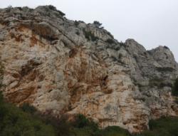
Baou de 4 Ouro
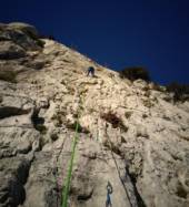


Interesting rock climbing area for routes up to 5c, from 6a to 6c, from 7a to 7c and starting from 8a (french grades).
Best time(s) :
- January
- February
- March
- April
- May
- June
- July
- August
- Sept.
- Oct.
- Nov.
- Dec.
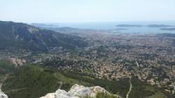
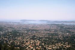
Aspect(s) : S-SE-E-NE-N Altitude : 450 m
Approach between 10 and 20 min up hill
Informations :
More than 300 routes, from 3a to 8b , spread over many crags Bolting : sport climbing
Max Height : 90 m.
Rock :
limestone. Characteristic(s) : overhang  , steep wall
  , vertical
  , slab
  . Type(s) of holds : crimps, cracks.
Legendary route(s) :
Trémolo 7a 3rd female 7a by Françoise Quintin on 1983.
Le Toit 7c+ 1st 7c+ in the world by Patrick Edlinger on 1981
Locations :
Area :
France, Provence-Alpes-Côte d'Azur, Var (83), Toulon, Le Boussan.
|
|
Latitude : 43° 9' 37" N | Longitude : 5° 53' 35" E | Sexagesimal & Orientation |
|
|
Latitude : 43° 9' 36" N | Longitude : 5° 53' 50" E | Sexagesimal & Orientation |
| More coordinates |
Area added by CA


