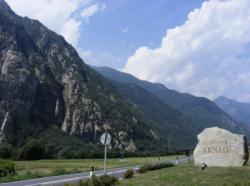
Arnad
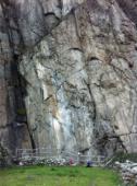
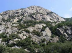
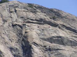
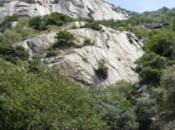
Interesting rock climbing area for routes up to 5c, from 6a to 6c, from 7a to 7c and starting from 8a (french grades).
![Information](/images/attention.png)
Many additional skills about progressing, belaying, escaping technics ... are necessary for multipitch routes security.
Best time(s) : - January
- February
- March
- April
- May
- June
- July
- August
- Sept.
- Oct.
- Nov.
- Dec.
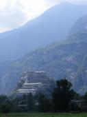
Aspect(s) : S Altitude : 650 m
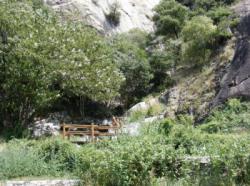
Approach between 5 and 45 min up hill. Kids friendly ? foot of the crag uneven for young kids.
Informations :
More than 100 routes, from 4c to 8c , spread over many crags Bolting : sport climbing
Max Height : 280 m.
Rock :
gneiss.
Characteristic(s) : slab
![Dalle](/images/dalle.png)
, vertical
![Vertical](/images/vertical.png)
.
Type(s) of holds : crimps, cracks.
Locations :
Area :
Italy, Valle d'Aosta, Provincia di Aosta, Aosta, Arnad.
![Information](/images/readme.png)
1. Zoom in to get all the rock climbing places 200 km around.
![](/images/mm_20_green.png)
: Bouldering
![](/images/mm_20_orange.png)
: Single pitch
![](/images/mm_20_red.png)
: Multi pitches
![](/images/mm_20_blue.png)
: Deep water soloing
![](/images/mm_20_white.png)
: Differents kind of climbing
Rock climbing area GPS Coordinates : |
Latitude : 45° 38' 1" N |
Longitude : 7° 44' 7" E |
Sexagesimal & Orientation
|
|
Latitude : 45° 38' 1" |
Longitude : 7° 44' 7" |
Degrees, Minutes, Seconds (DMS)
|
|
Latitude : 45° 38.031' |
Longitude : 7° 44.132' |
Degrees, Décimal minutes (DM)
|
|
Latitude : 45.633851° |
Longitude : 7.735534° |
Decimal degrees (DD)
|
|
Parking lot GPS Coordinates : |
Latitude : 45° 37' 53" N |
Longitude : 7° 44' 1" E |
Sexagesimal & Orientation
|
|
Latitude : 45° 37' 53" |
Longitude : 7° 44' 1" |
Degrees, Minutes, Seconds (DMS)
|
|
Latitude : 45° 37.884' |
Longitude : 7° 44.032' |
Degrees, Décimal minutes (DM)
|
|
Latitude : 45.631401° |
Longitude : 7.73387° |
Decimal degrees (DD)
|
Area added by CA