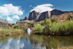
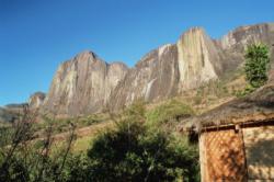
Tsaranoro
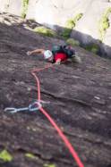
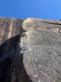
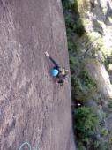
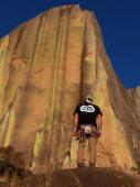
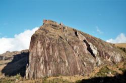
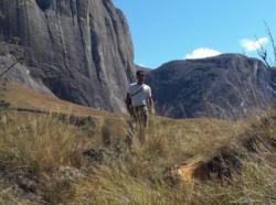
Interesting rock climbing area for routes from 7a to 7c and starting from 8a (french grades).
![Information](/images/attention.png)
Many additional skills about progressing, belaying, escaping technics ... are necessary for multipitch routes security.
Best time(s) : - January
- February
- March
- April
- May
- June
- July
- August
- Sept.
- Oct.
- Nov.
- Dec.
Aspect(s) : S Altitude : 1450 m
Approach up hill. Kids friendly ? foot of the crag uneven for young kids.
Informations :
Between 50 and 100 routes, from 3c to 8c , spread over many crags Bolting : traditionnal climbing, sport climbing
Max Height : 1100 m.
Rock :
granite.
Characteristic(s) : slab
![Dalle](/images/dalle.png)
, vertical
![Vertical](/images/vertical.png)
.
Type(s) of holds : crimps, cracks.
Legendary route(s) : Tough Enough 8c (400m, F.A. Adam Ondra octobre 2010)
Locations :
Area :
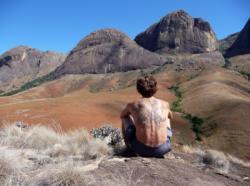
Madagascar, Province de Fianarantsoa, Région Haute Matsiatra, Ambalavao, Camp Catta.
![Information](/images/readme.png)
1. Zoom in to get all the rock climbing places 200 km around.
![](/images/mm_20_green.png)
: Bouldering
![](/images/mm_20_orange.png)
: Single pitch
![](/images/mm_20_red.png)
: Multi pitches
![](/images/mm_20_blue.png)
: Deep water soloing
![](/images/mm_20_white.png)
: Differents kind of climbing
Rock climbing area GPS Coordinates : |
Latitude : 21° 57' 50" S |
Longitude : 46° 55' 6" E |
Sexagesimal & Orientation
|
|
Latitude : -21° 57' 50" |
Longitude : 46° 55' 6" |
Degrees, Minutes, Seconds (DMS)
|
|
Latitude : -21° 57.848' |
Longitude : 46° 55.109' |
Degrees, Décimal minutes (DM)
|
|
Latitude : -21.964141° |
Longitude : 46.918488° |
Decimal degrees (DD)
|
VIDEOS
Area added by CA