
")
")


Tajos de Aldeide
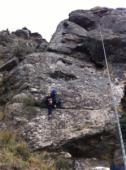
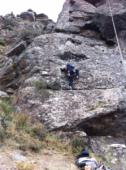
Interesting rock climbing area for routes up to 5c, from 6a to 6c and from 7a to 7c (french grades).
Best time(s) :
- January
- February
- March
- April
- May
- June
- July
- August
- Sept.
- Oct.
- Nov.
- Dec.
Aspect(s) : W-SW-S Altitude : 1450 m
Approach between 5 and 10 min easy down hill then easy up hill. Kids friendly ? foot of the crag comfortable for young kids.
Informations :
Between 25 and 50 routes, from 4a to 7c , spread over many crags Bolting : big run out climbing
Max Height : 18 m.
Rock :
. Characteristic(s) : dihedral  , overhang
  , steep wall
  , vertical
  , slab
  . Type(s) of holds : side pulls, underclings, jugs, pockets / holes, crimps, pebbles, cracks, tufas, slopers.
Further information(s) : Los croquis los conseguís en la Oficina de Interpretación de la Sierra, en el mismo pueblo.
Desde el aparcamiento hacia el sector sale un pequeño sendero a la derecha de la pista, ese es el buen camino si no luego es más difícil acceder.
Desde el aparcamiento hacia el sector sale un pequeño sendero a la derecha de la pista, ese es el buen camino si no luego es más difícil acceder.
Hay un corral de cabras al lado, respetadlo...
Locations :
Area :
Spain, Andalucía, Provincia de Granada, Granada, Capileira.
|
|
Latitude : 36° 57' 59" N | Longitude : 3° 21' 32" W | Sexagesimal & Orientation |
|
|
Latitude : 36° 57' 48" N | Longitude : 3° 21' 39" W | Sexagesimal & Orientation |
| More coordinates |
Area added by Anonimo


