")
")


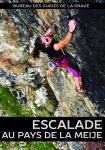
Roche Noire
Interesting rock climbing area for routes from 6a to 6c and from 7a to 7c (french grades).
Best time(s) :
- January
- February
- March
- April
- May
- June
- July
- August
- Sept.
- Oct.
- Nov.
- Dec.
Aspect(s) : SW Altitude : 2400 m
Approach 5 min easy down hill. Kids friendly ? foot of the crag reasonable for young kids.
Informations :
Between 10 and 25 routes, from 5c to 8a , spread over 1 crags Bolting : sport climbing
Max Height : 40 m.
Rock :
limestone. Characteristic(s) : dihedral  , overhang
  , steep wall
  , vertical
  , slab
  . Type(s) of holds : side pulls, jugs, pockets / holes, crimps, water erosion pockets, slopers.
Locations :
Area :
France, Provence-Alpes-Côte d'Azur, Hautes-Alpes (05), Briançon, La Grave.
|
|
Latitude : 45° 3' 11" N | Longitude : 6° 24' 15" E | Sexagesimal & Orientation |
|
|
Latitude : 45° 3' 13" N | Longitude : 6° 24' 16" E | Sexagesimal & Orientation |
| More coordinates |
Area added by Steph