
")
")


Placa verde
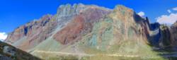
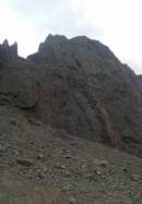
Interesting rock climbing area for routes from 6a to 6c (french grades).
Best time(s) :
- January
- February
- March
- April
- May
- June
- July
- August
- Sept.
- Oct.
- Nov.
- Dec.
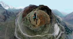
Aspect(s) : NW Altitude : 2150 m
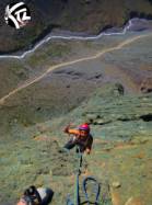
Approach 10 min easy down hill then easy up hill. Kids friendly ? foot of the crag dangerous for young kids.
Informations :
Between 10 and 25 routes, from 5.8 to 5.10c. Bolting : sport climbing
Max Height : 400 m.
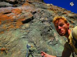
Rock :
. Characteristic(s) : slab  . Type(s) of holds : crimps, cracks.
Further information(s) : Es una vía de multilargos. 400 metros aprox de desnivel. Cuerda de 60 metros esta bien.
Locations :
Area :
Chile, Región Metropolitana de Santiago, Provincia de Cordillera, San José de Maipo, Baños Morales.
|
|
Latitude : 33° 49' 46" S | Longitude : 70° 2' 30" W | Sexagesimal & Orientation |
|
|
Latitude : 33° 49' 42" S | Longitude : 70° 2' 37" W | Sexagesimal & Orientation |
| More coordinates |
Area added by Rod

