
")
")


Pas de la Mala Dona
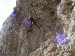
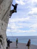
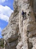
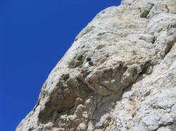
Interesting rock climbing area for routes from 6a to 6c and from 7a to 7c (french grades).
Best time(s) :
- January
- February
- March
- April
- May
- June
- July
- August
- Sept.
- Oct.
- Nov.
- Dec.
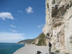
Aspect(s) : S-SE Altitude : 10 m
Approach 10 min steep down hill. Kids friendly ? foot of the crag dangerous for young kids.
Informations :
Between 25 and 50 routes, from 5c to 7c. Bolting : traditionnal climbing, sport climbing
Max Height : 90 m.
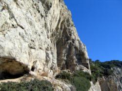
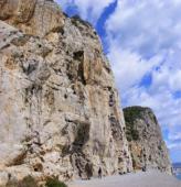
Rock :
limestone. Characteristic(s) : vertical  , steep wall
  . Type(s) of holds : cracks, crimps, tufas, slopers.
Locations :
Area :
Spain, Cataluña (Catalunya), Provincia de Barcelona, Barcelona, Garraf.
|
|
Latitude : 41° 14' 55" N | Longitude : 1° 53' 24" E | Sexagesimal & Orientation |
|
|
Latitude : 41° 14' 57" N | Longitude : 1° 53' 25" E | Sexagesimal & Orientation |
| More coordinates |
Area added by CA


