
")
")


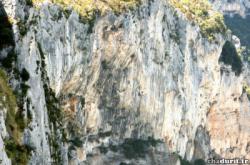
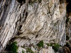
Les Gorges du Verdon (La Ramirole)
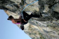
Interesting rock climbing area for routes starting from 8a (french grades).
Best time(s) :
- January
- February
- March
- April
- May
- June
- July
- August
- Sept.
- Oct.
- Nov.
- Dec.
Aspect(s) : N Altitude : 900 m
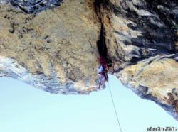
Approach 20 min steep down hill. Kids friendly ? foot of the crag dangerous for young kids.
Informations :
Between 25 and 50 routes, from 7b to 9c. Bolting : sport climbing
Max Height : 160 m.
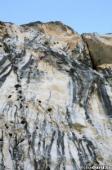
Rock :
limestone. Characteristic(s) : steep wall  . Type(s) of holds : ribs.
Legendary route(s) :
Ultime démence (160m) 8a+
A Muerte Bilou 9a (F.A. Sébastien Bouin août 2015)
Ultime démence L3-L4 8b+ 3rd female onsight 8b+ by Charlotte Durif on 27 oct 2009.
Basse température 8b+ 4th female onsight 8b+ by Charlotte Durif on 30 oct 2009.
Spanish Caravane 8c sent by Carole Palmier on 9 aug 2015. Firsts repeats : Janina Gmiter (2015), Anak Verhoeven (2017).
La Flûte en Chantier 8c+ sent by Nolwen Berthier on 29 oct 2020. Others outstandings sends : Laura Rogora (2024).
Promotion canne à pêche 9a first ascent by Sébastien Bouin on 30 aug 2011.
L'Homme Demain 9a/9a+ first ascent by Sébastien Bouin on 27 aug 2016.
La Côte d’Usure 9a+ first ascent by Sébastien Bouin on 23 sept 2018.
La Rage d'Adam 9b/9b+ first ascent by Sébastien Bouin on 6 sept 2019.
DNA 9c 2nd 9c in the world by Sébastien Bouin on 24 april 2022
Ultime démence (160m) 8a+
A Muerte Bilou 9a (F.A. Sébastien Bouin août 2015)
Locations :
Area :
France, Provence-Alpes-Côte d'Azur, Var (83), Draguignan, Aiguines.
|
|
Latitude : 43° 44' 4" N | Longitude : 6° 21' 38" E | Sexagesimal & Orientation |
|
|
Latitude : 43° 44' 7" N | Longitude : 6° 21' 55" E | Sexagesimal & Orientation |
| More coordinates |
VIDEOS
Area added by CA


