
")
")


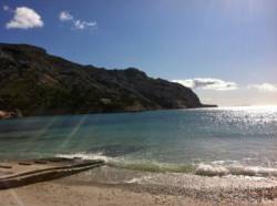
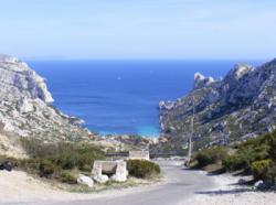
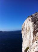
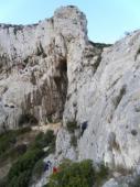
Les Calanques (Sormiou)
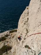

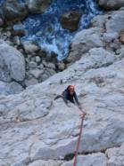


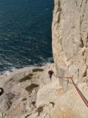


Interesting rock climbing area for routes up to 5c, from 6a to 6c and from 7a to 7c (french grades).
Best time(s) :
- January
- February
- March
- April
- May
- June
- July
- August
- Sept.
- Oct.
- Nov.
- Dec.
Aspect(s) : NW-W-SW-S-SE-E-N
Approach between 5 and 45 min up hill. Kids friendly ? foot of the crag uneven for young kids.
Informations :
More than 300 routes, from 3a to 8a , spread over many crags Bolting : sport climbing
Max Height : 70 m.
Rock :
limestone. Characteristic(s) : slab  , vertical
  , dihedral
  . Type(s) of holds : cracks, crimps, water erosion pockets.
Voir sur le site de la préfecture du 13 pour connaître les restriction concernant l'accès aux falaises.
Locations :
Area :
France, Provence-Alpes-Côte d'Azur, Bouches-du-Rhône (13), Marseille, Cayolle.
|
|
Latitude : 43° 12' 17" N | Longitude : 5° 25' 33" E | Sexagesimal & Orientation |
|
|
Latitude : 43° 12' 38" N | Longitude : 5° 25' 12" E | Sexagesimal & Orientation |
| More coordinates |
Area added by CA


