
")
")


La Roche Tuilière
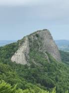

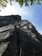
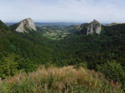
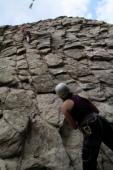
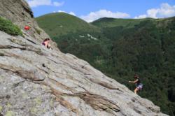

Interesting rock climbing area for routes from 6a to 6c (french grades).
Best time(s) :
- January
- February
- March
- April
- May
- June
- July
- August
- Sept.
- Oct.
- Nov.
- Dec.
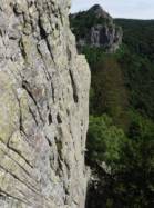
Aspect(s) : S Altitude : 1200 m
Approach 15 min down hill. Kids friendly ? foot of the crag reasonable for young kids.
Informations :
Between 10 and 25 routes, from 4a to 5a. Bolting : sport climbing
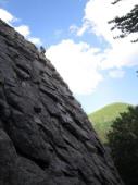
Max Height : 100 m.
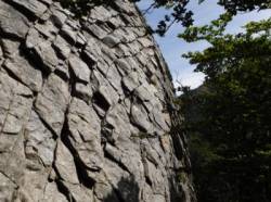
Rock :
phonolith. Characteristic(s) : slab  , vertical
  . Type(s) of holds : slopers.
Further information(s) : Accès : Se garer au parking du col de Guéry. Descendre 200m sur la route D80a en direction de Rochefort-Montagne. Quitter la route dans le virage en épingle à cheveu pour prendre la piste forestière sur la gauche. Au premier embranchement, continuer à descendre à droite. A environ 800m, on arrive devant une pancarte F.F.M.E. ; la falaise est en face, légèrement sur la droite en remontant.
Locations :
Area :
France, Auvergne-Rhône-Alpes, Puy-de-Dôme (63), Clermont Ferrand, Rochefort Montagne.
|
|
Latitude : 45° 37' 45" N | Longitude : 2° 48' 49" E | Sexagesimal & Orientation |
|
|
Latitude : 45° 37' 18" N | Longitude : 2° 49' 13" E | Sexagesimal & Orientation |
| More coordinates |
Area added by Linette50


