
")
")


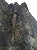
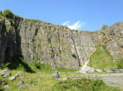
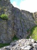
Horseshoe Quarry


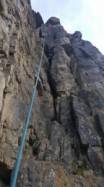

Interesting rock climbing area for routes up to 5c and from 6a to 6c (french grades).
Best time(s) :
- January
- February
- March
- April
- May
- June
- July
- August
- Sept.
- Oct.
- Nov.
- Dec.
Aspect(s) : All Altitude : 250 m
Approach 5 min on flat ground. Kids friendly ? foot of the crag reasonable for young kids.
Informations :
More than 200 routes, from 4a to 7b , spread over many crags Bolting : sport climbing
Max Height : 35 m.
Rock :
limestone. Characteristic(s) : vertical  . Type(s) of holds : crimps.
Further information(s) : Some great technical climbs there.
Locations :
Area :
United Kingdom, England, East Midlands, Derbyshire, Sheffield, Stoney Middleton.
|
|
Latitude : 53° 16' 56" N | Longitude : 1° 41' 16" W | Sexagesimal & Orientation |
|
|
Latitude : 53° 16' 49" N | Longitude : 1° 41' 24" W | Sexagesimal & Orientation |
| More coordinates |
Area added by someone who did not leave her/his name :)


