
")
")


Frankenjura (Haselstaudener Wände)
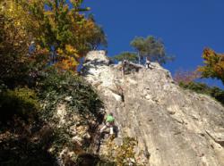
Interesting rock climbing area for routes up to 5c and from 6a to 6c (french grades).
Best time(s) :
- January
- February
- March
- April
- May
- June
- July
- August
- Sept.
- Oct.
- Nov.
- Dec.
Aspect(s) : SW-S-SE-E Altitude : 450 m
Approach 6 min easy up hill. Kids friendly ? foot of the crag comfortable for young kids.
Informations :
Between 25 and 50 routes, from 3+ to 8- , spread over many crags Bolting : traditionnal climbing, sport climbing
Max Height : 18 m.
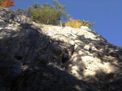
Rock :
limestone. Characteristic(s) : steep wall  , vertical
  . Type(s) of holds : pockets / holes, crimps.
Locations :
Area :
Germany, Bayern, Regierungsbezirk Oberfranken, Ebermannstadt, Obertrubach.
|
|
Latitude : 49° 41' 8" N | Longitude : 11° 17' 5" E | Sexagesimal & Orientation |
|
|
Latitude : 49° 41' 2" N | Longitude : 11° 17' 4" E | Sexagesimal & Orientation |
| More coordinates |
Area added by Sethai


