
")
")


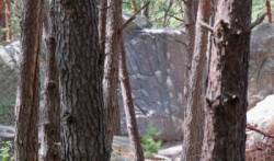
Fontainebleau (Franchard Cuisinière)
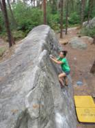
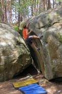

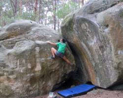
Interesting bouldering area for problems from 6a to 6c, from 7a to 7c and starting from 8a (Fontainebleau grades).
Best time(s) :
- January
- February
- March
- April
- May
- June
- July
- August
- Sept.
- Oct.
- Nov.
- Dec.
Aspect(s) : All Altitude : 100 m
Approach 10 min easy up hill. Kids friendly ? area around the boulders comfortable for young kids.
Informations :
More than 400 problems, from 4b to 8b. Bolting : sport climbing
Max Height : 6 m.
Rock :
sandstone. Characteristic(s) : steep wall  , vertical
  , slab
  . Type(s) of holds : crimps, slopers.
Landing quality : flat ground (1 crash pad needed) or uneven or steep ground (1 crash pad and 1 spotter needed).
Legendary problem(s) :
Échine 7b+ 3rd 7b+'s female boulder by Catherine Miquel on 1997.
Duel 8a 1st 8a's female boulder by Catherine Miquel on 12 oct 1998.
Liaison Futile 8a+ 1st 8a+'s female boulder by Catherine Miquel on 13 april 1999.
Green Fingers traversée sent by Caroline Sinno on 17 feb 2019.
Voluptueuse Fantaisie 8c traversée first ascent by Christophe Bichet on 22 may 2019
Locations :
Area :
France, Île-de-France, Seine-et-Marne (77), Melun, Fontainebleau, Arbonne-la-Forêt.
|
|
Latitude : 48° 24' 36" N | Longitude : 2° 36' 41" E | Sexagesimal & Orientation |
|
|
Latitude : 48° 24' 39" N | Longitude : 2° 35' 56" E | Sexagesimal & Orientation |
| More coordinates |
Area added by CA


