")
")


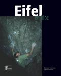
Eifel (Kottenheim)


Interesting rock climbing area for routes up to 5c, from 6a to 6c and from 7a to 7c (french grades).
Best time(s) :
- January
- February
- March
- April
- May
- June
- July
- August
- Sept.
- Oct.
- Nov.
- Dec.
Aspect(s) : All Altitude : 300 m
Approach 10 min easy down hill. Kids friendly ? foot of the crag reasonable for young kids.
Informations :
More than 400 routes, from III to IX , spread over many crags Bolting : traditionnal climbing, sport climbing
Max Height : 25 m.
Rock :
basalt. Characteristic(s) : steep wall  , vertical
  . Type(s) of holds : crimps, slopers.
Do not top rope routes. Loose boulders at the top!
Locations :
Area :
Germany, Rheinland-Pfalz, North, Koblenz, Kottenheim.
|
|
Latitude : 50° 21' 24" N | Longitude : 7° 14' 25" E | Sexagesimal & Orientation |
|
|
Latitude : 50° 21' 20" N | Longitude : 7° 14' 13" E | Sexagesimal & Orientation |
| More coordinates |
Area added by Christian