
")
")


Cochamó
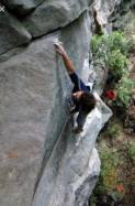
Interesting rock climbing area for routes from 7a to 7c and starting from 8a (french grades).
Best time(s) :
- January
- February
- March
- April
- May
- June
- July
- August
- Sept.
- Oct.
- Nov.
- Dec.
Aspect(s) : All Altitude : 1000 m
Approach up hill. Kids friendly ? foot of the crag uneven for young kids.
Informations :
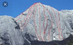
More than 100 routes, from 5.9 to 5.12d , spread over many crags Bolting : traditionnal climbing, sport climbing
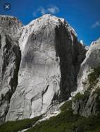
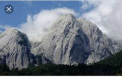
Max Height : 1200 m.
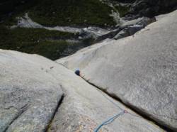
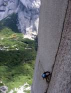
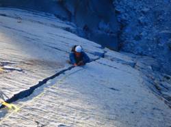
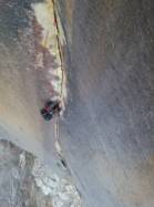
Rock :
granite. Characteristic(s) : slab  , vertical
  , dihedral
  . Type(s) of holds : cracks.
Further information(s) : Il existe un topo au refuge de Cochamó.
Web site(s) :
http://www.cochamo.com/climbing/
Locations :
Area :
Chile, X Región de Los Lagos, Provincia de Llanquihue, Puerto Montt, Cochamó.
|
|
Latitude : 41° 25' 47" S | Longitude : 72° 7' 0" W | Sexagesimal & Orientation |
| More coordinates |
VIDEOS
Area added by CA

