
")
")


Champer

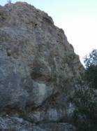

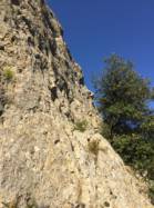

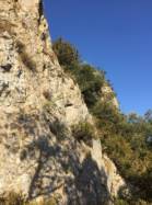
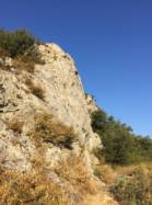
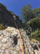


Interesting rock climbing area for routes up to 5c and from 6a to 6c (french grades).
Best time(s) :
- January
- February
- March
- April
- May
- June
- July
- August
- Sept.
- Oct.
- Nov.
- Dec.
Aspect(s) : N Altitude : 200 m
Approach 5 min easy up hill. Kids friendly ? foot of the crag reasonable for young kids.
Informations :
Between 50 and 100 routes, from 4a to 6c. Bolting : sport climbing
Max Height : 12 m.
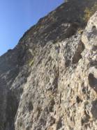
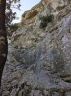
Rock :
limestone. Characteristic(s) : vertical  , slab
  . Type(s) of holds : crimps.
Further information(s) : juillet 2021, un utilisateur rapporte que l'accès est indiqué interdit sur le site de la FFME mais que le pied des voies semble être encore entretenu et/ou fréquenté.
Port du casque recommandé.
Locations :
Area :
France, Auvergne-Rhône-Alpes, Ardèche (07), Saint-Ambroix, Saint-Sauveur-de-Cruzières.
|
|
Latitude : 44° 17' 58" N | Longitude : 4° 14' 54" E | Sexagesimal & Orientation |
|
|
Latitude : 44° 17' 57" N | Longitude : 4° 15' 2" E | Sexagesimal & Orientation |
| More coordinates |
Area added by wismR


