Cap Salomon
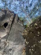
Interesting bouldering area for problems from 6a to 6c and from 7a to 7c (Fontainebleau grades).
Best time(s) :
- January
- February
- March
- April
- May
- June
- July
- August
- Sept.
- Oct.
- Nov.
- Dec.
Aspect(s) : All Altitude : 150 m
Approach 30 min easy up hill. Kids friendly ? area around the boulders reasonable for young kids.
Informations :
Between 25 and 50 problems, from 4a to 7a.
Max Height : 4 m.
Rock :
andésite. Characteristic(s) : steep wall  , vertical
  . Type(s) of holds : crimps, slopers.
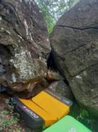
Landing quality : uneven or steep ground (1 crash pad and 1 spotter needed).
Legendary problem(s) : Bloc : Lou Casteu
Further information(s) : A Grande Anse d'Arlet, suivre le chemin communal de Ti Payot. Se garer devant le restaurant Ti Sable. Continuer à pied sur la route raide (allée des Raisiniers). Emprunter le chemin de randonnée qui monte à droite après 5 min de marche. Après 20 à 30 min de montée (et avant toute descente), dès que quelques blocs sont visibles autour du sentier, prendre un petit sentier à gauche qui se dirige vers des blocs en contrebas.
Les blocs sont dans le site naturel de Cap Salomon protégé par le Conservatoire du Littoral. Une convention autorise l'accès et la pratique. Soyez particulièrement respectueux de l'environnement et évitez laisser toute trace de votre passage.
Locations :
Area :
France, DROM-COM, Martinique (972), Fort-de-France, Le Marin, Les Anses-d'Arlet.
|
|
Latitude : 14° 30' 39" N | Longitude : 61° 5' 31" W | Sexagesimal & Orientation |
|
|
Latitude : 14° 30' 25" N | Longitude : 61° 5' 10" W | Sexagesimal & Orientation |
| More coordinates |
Area added by eloi


