
")
")


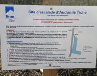
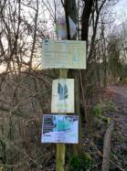
Audun-le-Tiche
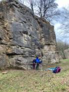

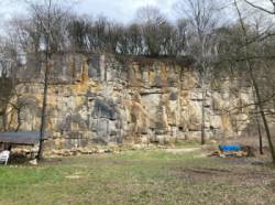

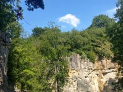
Interesting rock climbing area for routes up to 5c, from 6a to 6c and from 7a to 7c (french grades).
Best time(s) :
- January
- February
- March
- April
- May
- June
- July
- August
- Sept.
- Oct.
- Nov.
- Dec.
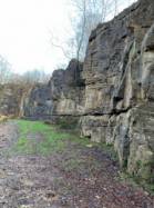
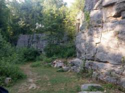
Aspect(s) : W-SW-S-SE-E Altitude : 350 m
Approach 1 min on flat ground. Kids friendly ? foot of the crag reasonable for young kids.
Informations :
Between 50 and 100 routes, from 3a to 7a. Bolting : sport climbing
Max Height : 17 m.
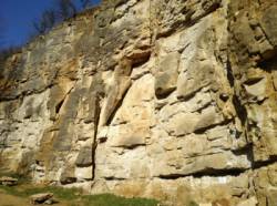
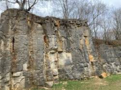
Rock :
limestone. Characteristic(s) : overhang  , vertical
  , slab
  . Type(s) of holds : crimps, cracks.
Further information(s) : Noms et cotations inscrits aux pieds des voies.
Quelques nouvelles voies équipées en 2017.
Quelques nouvelles voies équipées en 2017.
Locations :
Area :
France, Grand Est, Moselle (57), Thionville, Audun-le-Tiche.
|
|
Latitude : 49° 27' 35" N | Longitude : 5° 57' 50" E | Sexagesimal & Orientation |
|
|
Latitude : 49° 27' 39" N | Longitude : 5° 57' 49" E | Sexagesimal & Orientation |
| More coordinates |
Area added by quelqu'un qui n'a pas laissé son nom :)

