Sagres (Corgas)
Escuela interesante para sus vías del 7a al 7c y a partir del 8a .
Mejor(es) época(s) :
- Janvier
- Février
- Mars
- Avril
- Mai
- Juin
- Juillet
- Août
- Sept.
- Oct.
- Nov.
- Déc.
Orientación(es) : E
Approximación :10 min con rapel. Entorno : pie de las vías peligroso para los niños.
Informaciones :
Entre 10 y 25 vías, de 6b hasta 9a y proyectos. Equipamiento : deportiva
Altura máx : 40 m.
Roca :
caliza. Perfil(es) : despolm  . Tipos de agarres : regletas, planos.
Vía(s) mítica(s) : Peixe Porco 9a (1st 9a portuguese F.A. Leopolodo Faria 2 mars 2013)
Más informacione(s) : Informações e Croquis no Bar Dromedário em Sagres.
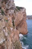
Perhaps the easiest access to some parts of this cliff may be by abseil ... once you know exactly where you are. Abseil point difficult to find. Otherwise it is best to descend a grassy gully to reach a fisher-mans ledge ... a short down-climb or little abseil gets you to a traverse in (rope protected). Abseil off the wrong place at the top and you will end up dangling above the sea.
Perhaps the easiest access to some parts of this cliff may be by abseil ... once you know exactly where you are. Abseil point difficult to find. Otherwise it is best to descend a grassy gully to reach a fisher-mans ledge ... a short down-climb or little abseil gets you to a traverse in (rope protected). Abseil off the wrong place at the top and you will end up dangling above the sea.
Ubicaciónes :
Lugar :
Portugal, Região do Algarve, Distrito de Faro, Portimão, Sagres.
|
|
Latitud : 37° 1' 25" N | Longitud : 8° 59' 6" W | Sexagésimales y Orientación |
|
|
Latitud : 37° 1' 38" N | Longitud : 8° 59' 8" W | Sexagésimales y Orientación |
| Más coordenadas |
VIDEOS
Escuela añadida por CA


