
")
")


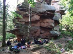
Le Muhlberg
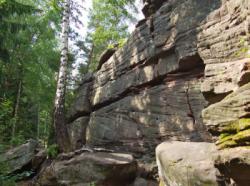
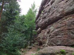
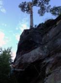
Interesting rock climbing area for routes up to 5c and from 6a to 6c (french grades).
Best time(s) :
- January
- February
- March
- April
- May
- June
- July
- August
- Sept.
- Oct.
- Nov.
- Dec.
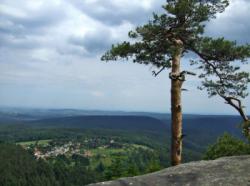
Aspect(s) : All Altitude : 600 m
Approach 10 min steep up hill. Kids friendly ? foot of the crag reasonable for young kids.
Informations :
Between 50 and 100 routes, from 5a to 7a , spread over 2 crags Bolting : sport climbing
Max Height : 15 m.
Rock :
sandstone. Characteristic(s) : slab  , vertical
  . Type(s) of holds : cracks, crimps, slopers.
Locations :
Area :
France, Grand Est, Bas-Rhin (67), Wasselonne, Obersteigen.
|
|
Latitude : 48° 38' 25" N | Longitude : 7° 17' 34" E | Sexagesimal & Orientation |
|
|
Latitude : 48° 38' 13" N | Longitude : 7° 17' 44" E | Sexagesimal & Orientation |
| More coordinates |
Area added by CA


