
")
")

Grimper autour de Rennes (Bretagne)
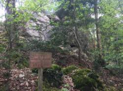
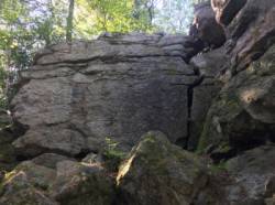
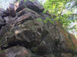
Roche Marie
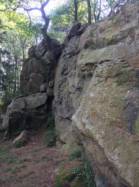
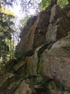

Site de voies d'une longueur intéressant pour ses voies jusqu'au 5c, du 6a au 6c et du 7a au 7c .
Meilleure(s) période(s) :
- Janvier
- Février
- Mars
- Avril
- Mai
- Juin
- Juillet
- Août
- Sept.
- Oct.
- Nov.
- Déc.
Altitude au pied des voies : 100 m
Marche d'approche : 2 min sur du plat. Environnement du site : pied des voies confortable pour les jeunes enfants.
Description de l'escalade :
Entre 10 et 25 voies, du 3a au 6c. Equipement : sportif
Hauteur max : 15 m.
Rocher :
grès. Profil(s) : dalle  , vertical
  , dévers
  . Type(s) de prises : réglettes.
Localisations :
Lieu :
France, Bretagne, Ille-et-Vilaine (35), Rennes, Saint-Aubin-du-Cormier.
|
|
Latitude : 48° 15' 37" N | Longitude : 1° 23' 4" W | Sexagésimales & Orientation |
|
|
Latitude : 48° 15' 36" N | Longitude : 1° 23' 18" W | Sexagésimales & Orientation |
| Plus de coordonnées |
Site ajouté par quelqu'un qui n'a pas laissé son nom :)


