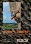
Grimper autour de Newcastle upon Tyne (England)
Causey Quarry Arch Wood
Site de et voies d'une longueur intéressant pour ses voies jusqu'au 5c, du 6a au 6c, du 7a au 7c et à partir du 8a .
Meilleure(s) période(s) :
- Janvier
- Février
- Mars
- Avril
- Mai
- Juin
- Juillet
- Août
- Sept.
- Oct.
- Nov.
- Déc.
Orientation(s) : NW Altitude au pied des voies : 150 m
Marche d'approche : 10 min en descente raide. Environnement du site : pied des voies correct pour les jeunes enfants.
Description de l'escalade :
Entre 25 et 50 voies, du V.S. 4b/c au E6 6b/c. Equipement : terrain d'aventure
Hauteur max : 18 m.
Rocher :
grès. Profil(s) : dalle  , vertical
  , dévers
  , surplomb
  . Type(s) de prises : verticales, grosses prises, réglettes, fissures, àplats.
Localisations :
Lieu :
United Kingdom, England, North East, Tyne and Wear, Newcastle upon Tyne, Stanley.
|
|
Latitude : 54° 53' 54" N | Longitude : 1° 41' 3" W | Sexagésimales & Orientation |
|
|
Latitude : 54° 53' 58" N | Longitude : 1° 40' 55" W | Sexagésimales & Orientation |
| Plus de coordonnées |
Site ajouté par Carl Ingham


