
")
")


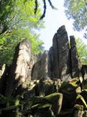
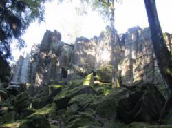
Steinwand (Rhön)
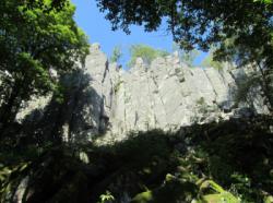


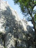
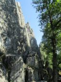
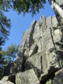


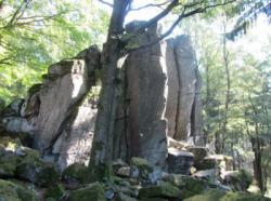


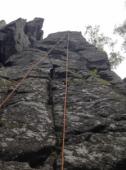

Interesting rock climbing area for routes up to 5c, from 6a to 6c and from 7a to 7c (french grades).
Best time(s) :
- January
- February
- March
- April
- May
- June
- July
- August
- Sept.
- Oct.
- Nov.
- Dec.
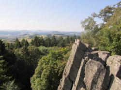
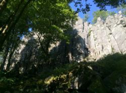
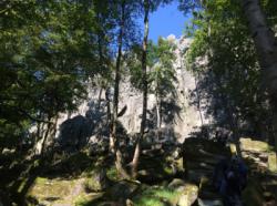
Aspect(s) : SE-E Altitude : 650 m
Approach 5 min easy down hill then easy up hill. Kids friendly ? foot of the crag reasonable for young kids.
Informations :
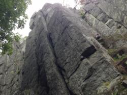
More than 100 routes, from 3 to 9+ , spread over many crags Bolting : traditionnal climbing, sport climbing
Max Height : 30 m.
Rock :
phonolith. Characteristic(s) : dihedral  , overhang
  , steep wall
  , vertical
  , slab
  . Type(s) of holds : underclings, jugs, pockets / holes, crimps, cracks, ribs, slopers.
Further information(s) : Top rope climbing: There are ancors and on top rings and chains for making a stand. At the most routes are 3 to 5 ancors which are reviewed annually.
Magnesiaverbot.
Web site(s) :
http://felsinfo.alpenverein.de/kletterfelsen/rhein-main-gebiet/steinwand/steinwand.html http://www.rhoenline.de/steinwand.html
Locations :
Area :
Germany, Hessen, Regierungsbezirk Kassel, Fulda, Steinwand (Rhön).
|
|
Latitude : 50° 31' 21" N | Longitude : 9° 51' 53" E | Sexagesimal & Orientation |
|
|
Latitude : 50° 31' 25" N | Longitude : 9° 51' 55" E | Sexagesimal & Orientation |
| More coordinates |
Area added by someone who did not leave her/his name :)

