
")
")


Remigny
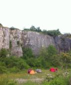

Interesting rock climbing area for routes up to 5c, from 6a to 6c and from 7a to 7c (french grades).
Aspect(s) : N Altitude : 250 m
Approach 2 min easy up hill. Kids friendly ? foot of the crag comfortable for young kids.
Informations :
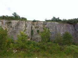
Between 50 and 100 routes, from 4a to 8a. Bolting : sport climbing
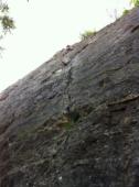
Max Height : 25 m.
Rock :
limestone. Characteristic(s) : steep wall  , vertical
  . Type(s) of holds : crimps, cracks.
Interdiction du 10 septembre au 1 mars.
Locations :
Area :
France, Bourgogne-Franche-Comté, Saône-et-Loire (71), Chalon-sur-Saône, Chagny.
|
|
Latitude : 46° 54' 16" N | Longitude : 4° 43' 58" E | Sexagesimal & Orientation |
|
|
Latitude : 46° 54' 16" N | Longitude : 4° 43' 55" E | Sexagesimal & Orientation |
| More coordinates |
Area added by someone who did not leave her/his name :)


