
")
")


Laus de Cervières (initiation)

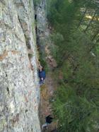
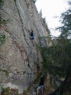

Interesting rock climbing area for routes up to 5c (french grades).
Best time(s) :
- January
- February
- March
- April
- May
- June
- July
- August
- Sept.
- Oct.
- Nov.
- Dec.
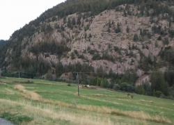
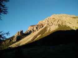
Aspect(s) : E Altitude : 1750 m
Approach 5 min down hill then up hill. Kids friendly ? foot of the crag reasonable for young kids.
Informations :
Between 10 and 25 routes, from 3b to 6a. Bolting : sport climbing
Max Height : 20 m.
Rock :
quartzite. Characteristic(s) : slab  . Type(s) of holds : side pulls, jugs, crimps.
Locations :
Area :
France, Provence-Alpes-Côte d'Azur, Hautes-Alpes (05), Briançon, Cervières.
|
|
Latitude : 44° 51' 38" N | Longitude : 6° 43' 22" E | Sexagesimal & Orientation |
|
|
Latitude : 44° 51' 39" N | Longitude : 6° 43' 24" E | Sexagesimal & Orientation |
| More coordinates |
Area added by quelqu'un qui n'a pas laissé son nom :)


