")
")


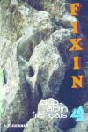
Fixin


Interesting rock climbing area for routes up to 5c, from 6a to 6c, from 7a to 7c and starting from 8a (french grades).
Best time(s) :
- January
- February
- March
- April
- May
- June
- July
- August
- Sept.
- Oct.
- Nov.
- Dec.
Aspect(s) : S Altitude : 400 m
Approach between 5 and 10 min down hill. Kids friendly ? foot of the crag uneven for young kids.
Informations :
More than 200 routes, from 3a to 8c. Bolting : sport climbing
Max Height : 35 m.
Rock :
limestone. Characteristic(s) : slab  , vertical
  , steep wall
  . Type(s) of holds : cracks.
Legendary route(s) : High voltage 8c+ (F.A. Pierre Duroché mai 2010)
Further information(s) : Depuis le parking, suivre le sentier balisé en jaune pour accéder au pied des voies.
Chutes de pierres possibles. Mettez un casque !
Locations :
Area :
France, Bourgogne-Franche-Comté, Côte-d'Or (21), Dijon, Fixin.
|
|
Latitude : 47° 15' 3" N | Longitude : 4° 57' 7" E | Sexagesimal & Orientation |
|
|
Latitude : 47° 15' 3" N | Longitude : 4° 57' 22" E | Sexagesimal & Orientation |
| More coordinates |
Area added by CA