
")
")


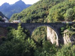
Pont Napoleon

Interesting rock climbing area for routes from 7a to 7c (french grades).
Best time(s) :
- January
- February
- March
- April
- May
- June
- July
- August
- Sept.
- Oct.
- Nov.
- Dec.
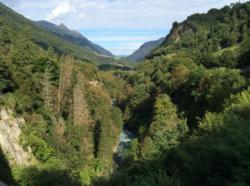
Aspect(s) : W-SW Altitude : 800 m
Approach 10 min easy down hill. Kids friendly ? foot of the crag comfortable for young kids.
Informations :
Between 10 and 25 routes, from 6b to 8a. Bolting : sport climbing
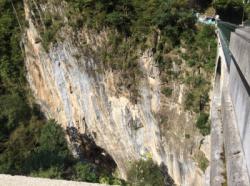
Max Height : 40 m.
Rock :
limestone. Characteristic(s) : vertical  , steep wall
  . Type(s) of holds : side pulls, underclings, jugs, pockets / holes, crimps, cracks, ribs.
We liked this/these route(s) : Ticou 64 : 7A+? la reprise 7B
Locations :
Area :
France, Occitanie, Hautes-Pyrénées (65), Tarbes, Luz-Saint-Sauveur.
|
|
Latitude : 42° 51' 30" N | Longitude : 0° 0' 21" W | Sexagesimal & Orientation |
|
|
Latitude : 42° 51' 32" N | Longitude : 0° 0' 23" W | Sexagesimal & Orientation |
| More coordinates |
Area added by Latomme

