
")
")


Recuevas
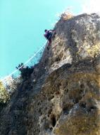
Interesting rock climbing area for routes up to 5c, from 6a to 6c and from 7a to 7c (french grades).
Best time(s) :
- January
- February
- March
- April
- May
- June
- July
- August
- Sept.
- Oct.
- Nov.
- Dec.
Aspect(s) : All Altitude : 1000 m
Approach 15 min easy up hill. Kids friendly ? foot of the crag comfortable for young kids.
Informations :
More than 200 routes, from 4a to 8b , spread over many crags Bolting : sport climbing
Max Height : 25 m.
Rock :
limestone. Characteristic(s) : dihedral  , overhang
  , steep wall
  , vertical
  , slab
  . Type(s) of holds : side pulls, underclings, jugs, pockets / holes, crimps, cracks.
Locations :
Area :
Spain, Castilla y León, Provincia de Palencia, Aguilar de Campoo, Villallano, Gama.
|
|
Latitude : 42° 44' 58" N | Longitude : 4° 13' 19" W | Sexagesimal & Orientation |
|
|
Latitude : 42° 44' 53" N | Longitude : 4° 12' 36" W | Sexagesimal & Orientation |
| More coordinates |
Area added by True

